


Property history for 162 Burniston Street, Scarborough WA 6019
All Sold Rent
Apr 2014
$817,500- Sold
- Ray White - North Quays
Mar 2014
$817,500- Sold
- Ray White Sorrento
Oct 2013
$850 per week- Rent
- Ray White North Quays
Jan 2013
$860 per week- Rent
- Ray White - North Quays
May 2012
$920 per week- Rent
- Ray White - North Quays
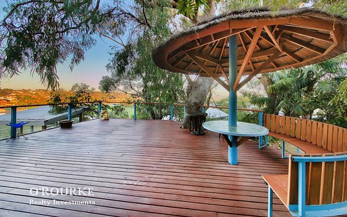
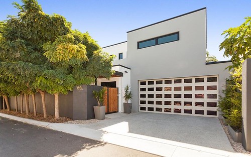
About this property
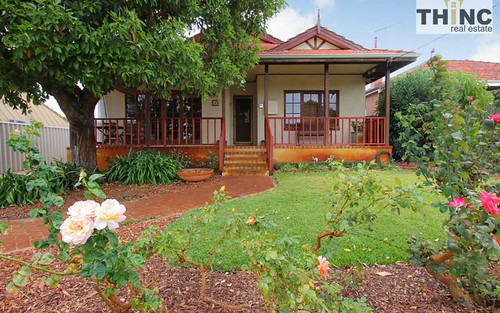
162 Burniston Street, Scarborough WA 6019
| Bedrooms | 4 |
| Bathrooms | 2 |
| Car Spaces | 2 |
| Land Size | 216 m2 |
| Building Area | 179 m2 |
| Property Type | house |
| Council Area | Stirling |
| Year Built | 2011 |
| Lot/Plan | 771/P059724 |
| Suburb Name | Scarborough |
| Postcode | 6019 |
| State | WA |
Comparable Sold properties in Scarborough
Looking at similar homes in Scarborough, WA 6019 can help you better understand this unit's potential value.


Comparable Rent properties in Scarborough
Looking at similar homes in Scarborough, WA 6019 can help you better understand this unit's potential value.


Schools closest to 162 Burniston Street, Scarborough WA 6019
| School name | Address | Type | Sector | Distance |
|---|---|---|---|---|
| St John's Primary School | 21 LALOR STREETScarborough 6019 | Primary | Catholic | 0.37 km |
| Scarborough Primary School | HINDERWELL STREETScarborough 6019 | Primary | Government | 0.48 km |
| Doubleview Primary School | ST BRIGIDS TERRACEDoubleview 6018 | Primary | Government | 0.87 km |
| Deanmore Primary School | DEANMORE ROADKarrinyup 6018 | Primary | Government | 1.21 km |
| Newborough Primary School | NEWBOROUGH STREETKarrinyup 6018 | Primary | Government | 1.48 km |
| Our Lady of Good Counsel School | 117 MILES STREETKarrinyup 6018 | Primary | Catholic | 1.58 km |
| Wembley Downs Primary SchoolTop 100 | BOURNEMOUTH CRESCENTWembley Downs 6019 | Primary | Government | 1.88 km |
| St Mary's Anglican Girls' School (Inc)Top 5 | 75 ELLIOTT RDKarrinyup 6018 | Combined | Independent | 1.88 km |
| Yuluma Primary School | AMBROSE STREETInnaloo 6018 | Primary | Government | 1.85 km |
| St Dominic's School | 95 BEATRICE STREETInnaloo 6018 | Primary | Catholic | 1.89 km |
Neighbouring properties to 162 Burniston Street, Scarborough WA 6019
Explore other properties on Scarborough, WA 6019.
Suburb Information
Scarborough, WA 6019
Part of Stirling
11.52 km
Distance from Perth CBD
18 k
Population
$910K
Median House Price
$550K
Median Unit Price