


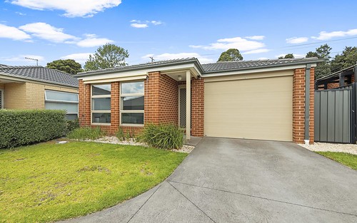
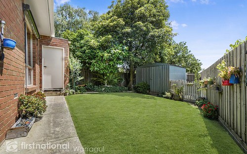
Property history for 2/85 Brandy, warragul VIC 3820
All Sold Rent
Mar 2013
$520,000- Sold
This property has no listed rental history.
About this property
2/85 Brandy, warragul VIC 3820
| Bedrooms | 2 |
| Bathrooms | 1 |
| Car Spaces | 1 |
| Land Size | 139 m2 |
| Building Area | 63 m2 |
| Property Type | unit |
| Council Area | Baw Baw |
| Year Built | 1970 |
| Lot/Plan | 2/RP16389 |
| Suburb Name | warragul |
| Postcode | 3820 |
| State | VIC |
Comparable Sold properties in warragul
Looking at similar homes in warragul, VIC 3820 can help you better understand this unit's potential value.


Comparable Rent properties in warragul
Looking at similar homes in warragul, VIC 3820 can help you better understand this unit's potential value.


Schools closest to 2/85 Brandy, warragul VIC 3820
| School name | Address | Type | Sector | Distance |
|---|---|---|---|---|
| Warragul North Primary School | O'DOWDS ROADWarragul 3820 | Primary | Government | 0.39 km |
| St Paul's Anglican Grammar School | 150 BOWEN STREETWarragul 3820 | Combined | Independent | 0.56 km |
| Warragul Primary School | 44 BOWEN STREETWarragul 3820 | Primary | Government | 1.57 km |
| Warragul Regional College | 55 BURKE STREETWarragul 3820 | Secondary | Government | 2.51 km |
Neighbouring properties to 2/85 Brandy, warragul VIC 3820
Explore other properties on warragul, VIC 3820.
Suburb Information
Warragul, VIC 3820
Part of Baw Baw
93.29 km
Distance from Melbourne CBD
14 k
Population
$673K
Median House Price
$400K
Median Unit Price