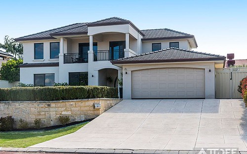
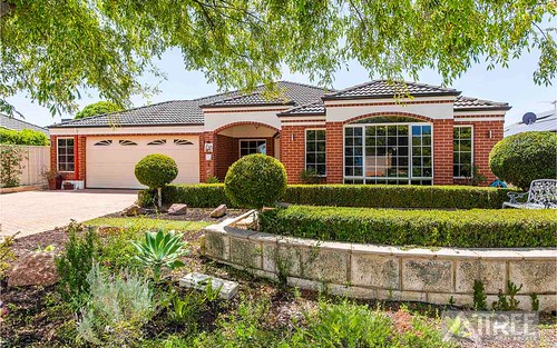
Property history for 22 Blenheim Road, Canning Vale WA 6155
All Sold Rent
Mar 2018
$1,600,000- Sold
Sep 2012
$1,300,000- Sold
Jan 2009
$781,000- Sold
This property has no listed rental history.
About this property
22 Blenheim Road, Canning Vale WA 6155
| Bedrooms | 5 |
| Bathrooms | 3 |
| Car Spaces | 3 |
| Land Size | 995 m2 |
| Building Area | n/a |
| Property Type | house |
| Council Area | Gosnells |
| Year Built | 2012 |
| Lot/Plan | 104/P069409 |
| Suburb Name | Canning Vale |
| Postcode | 6155 |
| State | WA |
Comparable Sold properties in Canning Vale
Looking at similar homes in Canning Vale, WA 6155 can help you better understand this unit's potential value.
Comparable Rent properties in Canning Vale
Looking at similar homes in Canning Vale, WA 6155 can help you better understand this unit's potential value.
Schools closest to 22 Blenheim Road, Canning Vale WA 6155
| School name | Address | Type | Sector | Distance |
|---|---|---|---|---|
| Excelsior Primary School | SHREEVE ROADCanning Vale 6155 | Primary | Government | 0.97 km |
| Thornlie Christian CollegeTop 50 | 19 FURLEY ROADSouthern River 6110 | Combined | Independent | 1.13 km |
| Campbell Primary School | CAMPBELL ROADCanning Vale 6155 | Primary | Government | 1 km |
| St Emilie's Catholic Primary SchoolTop 100 | 151 AMHERST ROADCanning Vale 6155 | Primary | Catholic | 1.2 km |
| Bletchley Park Primary School | BALFOUR STREETSouthern River 6110 | Primary | Government | 1.52 km |
| Forest Crescent Primary School | FOREST CRESCENTThornlie 6108 | Primary | Government | 1.78 km |
| Caladenia Primary School | FRASER ROAD NORTHCanning Vale 6155 | Primary | Government | 1.84 km |
| Canning Vale College | DUMBARTON ROADCanning Vale 6155 | Secondary | Government | 1.89 km |
Neighbouring properties to 22 Blenheim Road, Canning Vale WA 6155
Explore other properties on Canning Vale, WA 6155.
Suburb Information
Canning Vale, WA 6155
Part of Canning
13.52 km
Distance from Perth CBD
31 k
Population
$654K
Median House Price
$406K
Median Unit Price


