Property history for 1/2 Rodger Avenue, Leabrook SA 5068
All Sold Rent
Nov 2020
$525,000- Sold
- Harcourts - Sheppard Property (RLA 211280)
Nov 2020
N/A- Sold
- Harcourts - Sheppard Property (RLA 211280)
Jun 2013
$350 per week- Rent
- Eastern Property Rentals - Linden Park
Apr 2007
$420,000- Sold
- Toop & Toop
Apr 2005
$332,500- Sold
- Adelaide Living
Jun 2004
$180,000- Sold
- Toop & Toop
Oct 1999
$125,000- Sold
About this property
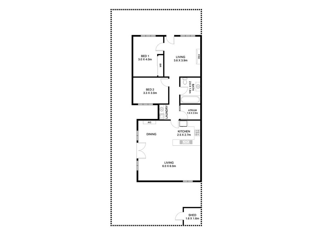
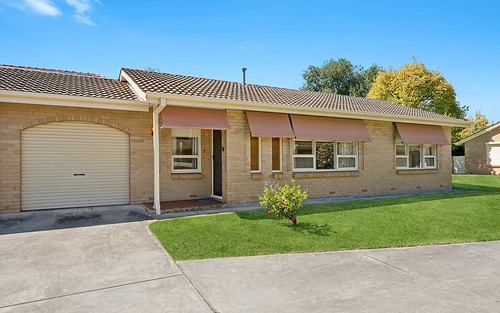
1/2 Rodger Avenue, Leabrook SA 5068
| Bedrooms | 2 |
| Bathrooms | 1 |
| Car Spaces | 0 |
| Land Size | 176 m2 |
| Building Area | 98 m2 |
| Property Type | unit |
| Council Area | n/a |
| Year Built | 1890 |
| Lot/Plan | n/a |
| Suburb Name | Leabrook |
| Postcode | 5068 |
| State | SA |
Comparable Sold properties in Leabrook
Looking at similar homes in Leabrook, SA 5068 can help you better understand this unit's potential value.
Comparable Rent properties in Leabrook
Looking at similar homes in Leabrook, SA 5068 can help you better understand this unit's potential value.
Schools closest to 1/2 Rodger Avenue, Leabrook SA 5068
| School name | Address | Type | Sector | Distance |
|---|---|---|---|---|
| Marryatville High SchoolTop 20 | KENSINGTON ROADMarryatville 5068 | Secondary | Government | 0.81 km |
| Marryatville Primary SchoolTop 20 | DANKEL AVENUEKensington 5068 | Primary | Government | 0.95 km |
| Burnside Primary SchoolTop 50 | HIGH STREETBurnside 5066 | Primary | Government | 0.87 km |
| Pembroke Senior SchoolTop 10 | Kensington Park 5068 | Combined | Independent | 1.21 km |
| Loreto CollegeTop 50 | 316 PORTRUSH RDMarryatville 5068 | Combined | Catholic | 1.05 km |
| Mary MacKillop CollegeTop 100 | 10 HIGH STREETKensington 5068 | Secondary | Independent | 1.42 km |
| St Ignatius' College CampusTop 10 | Norwood 5067 | Combined | Catholic | 1.57 km |
| St Peter's Collegiate Girls' SchoolTop 10 | STONYFELL ROADStonyfell 5066 | Combined | Independent | 1.48 km |
| Linden Park Primary SchoolTop 5 | HAY ROADLinden Park 5065 | Primary | Government | 1.85 km |
| St Joseph's School | 1 BIRKINSHAW AVENUETranmere 5073 | Primary | Catholic | 2.45 km |
Neighbouring properties to 1/2 Rodger Avenue, Leabrook SA 5068
Explore other properties on Leabrook, SA 5068.
Suburb Information
Leabrook, SA 5068
Part of Burnside
4.70 km
Distance from Adelaide CBD
12 k
Population
$1.73M
Median House Price
$460K
Median Unit Price
Auction Results For Leabrook
Units sold in Last 12 months ends 11 Jan 2025
$1.43M
Median Sale Price
75%
Clearance Rate
3/4
Sold/Reported
$1.43M
Highest Sale Price
| Sold Price Range | No. of Sold Properties | |
|---|---|---|
| $1.4 M - $1.6 M (Median Price Range) | 1 | |
| $400 K - $600 K | 1 | |


