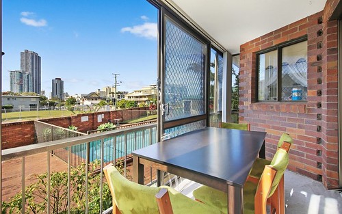
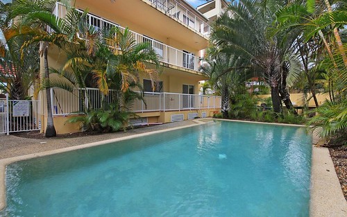
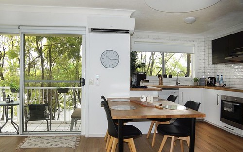
Property history for 2/31 Binstead Drive, Southport QLD 4215
All Sold Rent
Mar 2024
$620 per week- Rent
- Property Owl - MITCHELTON
Aug 2021
$400 per week- Rent
- Property Owl - MITCHELTON
Oct 2015
$350 per week- Rent
- Elliott Michaels Realtor - Southport
Oct 2014
$325 per week- Rent
- Elliott Michaels Realtor - Southport
May 2013
$275,750- Sold
- Elliott Michaels Realtor - Southport
Mar 2013
$275,750- Sold
- Elliott Michaels Realtor - Southport
Dec 2010
$320 per week- Rent
- Elliott Michaels Realtor - Southport
Apr 2008
$130,000- Sold
- Elliott Michaels Realtor - Southport
Feb 1994
$124,000- Sold
Jun 1993
$122,000- Sold
Jun 1991
$112,500- Sold
About this property
2/31 Binstead Drive, Southport QLD 4215
| Bedrooms | 2 |
| Bathrooms | 1 |
| Car Spaces | 1 |
| Land Size | 83 m2 |
| Building Area | 79 m2 |
| Property Type | unit |
| Council Area | Gold Coast City - Gold Coast |
| Year Built | 1990 |
| Lot/Plan | 2/BUP7163 |
| Suburb Name | Southport |
| Postcode | 4215 |
| State | QLD |
Comparable Sold properties in Southport
Looking at similar homes in Southport, QLD 4215 can help you better understand this unit's potential value.
Comparable Rent properties in Southport
Looking at similar homes in Southport, QLD 4215 can help you better understand this unit's potential value.
Schools closest to 2/31 Binstead Drive, Southport QLD 4215
| School name | Address | Type | Sector | Distance |
|---|---|---|---|---|
| Labrador State School | TURPIN ROADLabrador 4215 | Primary | Government | 0.52 km |
| Southport State School | QUEEN STREETSouthport 4215 | Primary | Government | 0.63 km |
| Queensland Academy for Health Sciences | EDMUND RICE DRIVESOUTHPORT 4215 | Secondary | Government | 1 km |
| Guardian Angels' Catholic Primary School | EDMUND RICE DRIVEAshmore 4214 | Primary | Catholic | 1.06 km |
| Aquinas College | EDMUND RICE DRIVEAshmore 4214 | Secondary | Catholic | 1.22 km |
| Keebra Park State High School | ANNE STREETSouthport 4215 | Secondary | Government | 1.36 km |
| St Hilda's SchoolTop 50 | 52 HIGH STREETSouthport 4215 | Combined | Independent | 1.26 km |
| Musgrave Hill State School | NAKINA STREETSouthport 4215 | Primary | Government | 1.44 km |
| Southport State High School | SMITH STREETSouthport 4215 | Secondary | Government | 1.47 km |
| Ashmore State School | CURRUMBURRA ROADAshmore 4214 | Primary | Government | 2.31 km |
Neighbouring properties to 2/31 Binstead Drive, Southport QLD 4215
Explore other properties on Southport, QLD 4215.
Suburb Information
Southport, QLD 4215
Part of Gold Coast
67.35 km
Distance from Brisbane CBD
40 k
Population
$895K
Median House Price
$485K
Median Unit Price
Auction Results For Southport
Units sold in Last 12 months ends 18 Jan 2025
$879K
Median Sale Price
43%
Clearance Rate
6/14
Sold/Reported
$1.13M
Highest Sale Price
| Sold Price Range | No. of Sold Properties | |
|---|---|---|
| $1 M - $1.2 M | 1 | |
| $800 K - $1 M (Median Price Range) | 1 | |
| $600 K - $800 K | 1 | |
| less than $400 K | 1 | |


