Property history for 3/70A Railway Parade, Glenfield NSW 2167
All Sold Rent
This property has no listed sales or rental history.
This property has no listed sales history.
This property has no listed rental history.
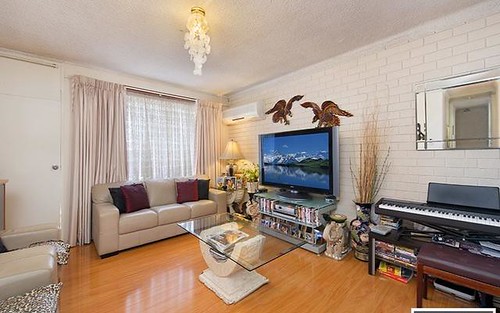
About this property
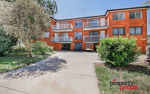
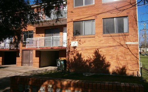
3/70A Railway Parade, Glenfield NSW 2167
| Bedrooms | 0 |
| Bathrooms | 0 |
| Car Spaces | 0 |
| Land Size | n/a |
| Building Area | n/a |
| Property Type | unit |
| Council Area | n/a |
| Year Built | 2008 |
| Lot/Plan | n/a |
| Suburb Name | Glenfield |
| Postcode | 2167 |
| State | NSW |
Comparable Sold properties in Glenfield
Looking at similar homes in Glenfield, NSW 2167 can help you better understand this unit's potential value.


Comparable Rent properties in Glenfield
Looking at similar homes in Glenfield, NSW 2167 can help you better understand this unit's potential value.


Schools closest to 3/70A Railway Parade, Glenfield NSW 2167
| School name | Address | Type | Sector | Distance |
|---|---|---|---|---|
| Glenfield Public School | RAILWAY PDEGlenfield 2167 | Primary | Government | 0.12 km |
| Glenwood Public School | BELMONT RDGlenfield 2167 | Primary | Government | 0.8 km |
| Glenfield Park School | ROY WATTS RDGlenfield 2167 | Combined | Government | 0.83 km |
| Hurlstone Agricultural High SchoolTop 20 | ROY WATTS RDGlenfield 2167 | Secondary | Government | 0.91 km |
| Campbell House School | ROY WATTS RDGlenfield 2167 | Combined | Government | 1.44 km |
| Macarthur Adventist College | 12 VICTORIA ROADMacquarie Fields 2564 | Combined | Independent | 1.62 km |
| Guise Public School | EUCALYPTUS DRIVEMacquarie Fields 2564 | Primary | Government | 1.76 km |
| James Meehan High School | HAROLD STMacquarie Fields 2564 | Secondary | Government | 1.95 km |
| Casula High School | MYALL RDCasula 2170 | Secondary | Government | 2.05 km |
| All Saints Catholic Senior College | LEACOCKS LANECasula 2170 | Secondary | Catholic | 1.96 km |
Neighbouring properties to 3/70A Railway Parade, Glenfield NSW 2167
Explore other properties on Glenfield, NSW 2167.
Suburb Information
Glenfield, NSW 2167
Part of Campbelltown
30.80 km
Distance from Sydney CBD
8 k
Population
$938K
Median House Price
$580K
Median Unit Price