


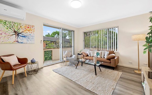
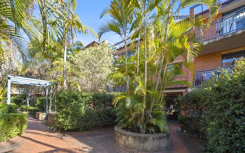
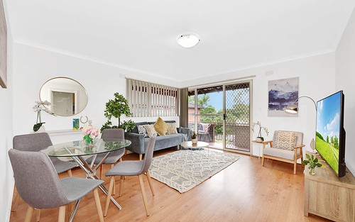
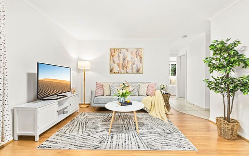
Property history for 42/38 Wallace Street, Ashfield NSW 2131
All Sold Rent
Nov 2021
$1,850,000- Sold
- Raine & Horne - Ashfield
Nov 2021
N/A- Sold
- Raine & Horne - Ashfield
Mar 2006
$425 per week- Rent
Nov 2005
$425 per week- Rent
Sep 2000
$410,000- Sold
Apr 1996
$305,000- Sold
About this property
42/38 Wallace Street, Ashfield NSW 2131
| Bedrooms | 3 |
| Bathrooms | 2 |
| Car Spaces | 2 |
| Land Size | 10880000 m2 |
| Building Area | 126 m2 |
| Property Type | unit |
| Council Area | Inner West |
| Year Built | 1995 |
| Lot/Plan | 42/SP51500 |
| Suburb Name | Ashfield |
| Postcode | 2131 |
| State | NSW |
Comparable Sold properties in Ashfield
Looking at similar homes in Ashfield, NSW 2131 can help you better understand this unit's potential value.


Comparable Rent properties in Ashfield
Looking at similar homes in Ashfield, NSW 2131 can help you better understand this unit's potential value.


Schools closest to 42/38 Wallace Street, Ashfield NSW 2131
| School name | Address | Type | Sector | Distance |
|---|---|---|---|---|
| Ashfield Boys High School | LIVERPOOL RDAshfield 2131 | Secondary | Government | 0.38 km |
| Ashfield Public School | LIVERPOOL RDAshfield 2131 | Primary | Government | 0.44 km |
| St Vincent's Catholic Primary School | 30-34 CHARLOTTE STREETAshfield 2131 | Primary | Catholic | 0.57 km |
| De La Salle College | 24 BLAND STAshfield 2131 | Secondary | Catholic | 0.64 km |
| Bethlehem College | 18 BLAND STREETAshfield 2131 | Secondary | Catholic | 0.66 km |
| Haberfield Public School | DENMAN AVEHaberfield 2045 | Primary | Government | 0.78 km |
| St Patrick's Catholic Primary School | 9 DRYNAN STSummer Hill 2130 | Primary | Catholic | 0.79 km |
| Summer Hill Public SchoolTop 100 | MOONBIE STSummer Hill 2130 | Primary | Government | 1.06 km |
| St Joan Of Arc Catholic Primary School | 88 DALHOUSIE STHaberfield 2045 | Primary | Catholic | 1.13 km |
| Trinity Grammar School | PROSPECT ROADSummer Hill 2130 | Combined | Independent | 1.37 km |
Neighbouring properties to 42/38 Wallace Street, Ashfield NSW 2131
Explore other properties on Ashfield, NSW 2131.
Suburb Information
Ashfield, NSW 2131
Part of Ashfield
7.69 km
Distance from Sydney CBD
22 k
Population
$1.89M
Median House Price
$740K
Median Unit Price
Auction Results For Ashfield
Units sold in Last 12 months ends 9 Nov 2024
$875K
Median Sale Price
87%
Clearance Rate
103/119
Sold/Reported
$2.66M
Highest Sale Price
| Sold Price Range | No. of Sold Properties | |
|---|---|---|
| $2 M - $3 M | 4 | |
| $1.4 M - $1.6 M | 2 | |
| $1.2 M - $1.4 M | 5 | |
| $1 M - $1.2 M | 9 | |
| $800 K - $1 M (Median Price Range) | 40 | |
| $600 K - $800 K | 17 | |
| $400 K - $600 K | 3 | |